Inside Hawaii’s Sea Turtle Tagging Programs: What Researchers Are Learning
Hawaii’s green sea turtles have been swimming these waters for millions of years, but it wasn’t until researchers started tagging and tracking individual turtles that we began to truly understand how far they travel, where they nest, and how the population is doing. A combination of satellite technology, flipper tags, and photo identification is now giving scientists a clearer picture than ever of what Hawaii’s honu are up to beneath the surface. If you have ever snorkeled with a turtle at Turtle Canyon off Waikiki and wondered where that turtle goes when the day is done, the answer might surprise you.
Why Tracking Sea Turtles Matters
Before tagging programs existed, researchers had little more than guesswork to work with when it came to sea turtle movements. They knew turtles fed in Hawaiian waters and nested somewhere, but the details were a mystery. That changed when NOAA and Hawaii’s Division of Aquatic Resources began attaching identification tags to individual turtles and recording sightings over time. What they discovered reshaped how we manage and protect the species in the Pacific. Population counts became possible. Migration routes could be mapped. Disease spread could be followed from turtle to turtle. None of that would have been possible without tagging.
The green sea turtle, or honu, was listed as threatened under the Endangered Species Act in 1978, and tracking programs have been central to measuring its recovery ever since. The long-term monitoring data collected over the past five decades has shown a meaningful increase in the number of nesting turtles at Hawaii’s primary nesting sites, particularly in the Northwestern Hawaiian Islands. That kind of progress only becomes visible when you are following individual animals year after year.
How Flipper Tags Work
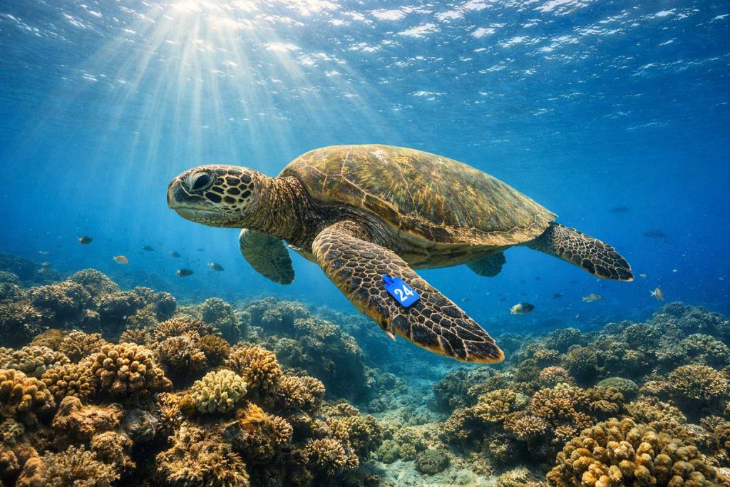
The most basic and widely used method is the metal or plastic flipper tag. A small numbered band is attached to the front flipper of a captured turtle, similar in concept to a bird band. When that turtle is spotted again, whether by a researcher, a snorkel guide, or a diver with a camera, the tag number can be reported and logged. Over time, resightings build a history for each tagged individual, revealing where it forages, how often it returns to the same area, and whether it has new injuries or signs of illness.
Flipper tags are low-tech and relatively low cost, which makes them practical for large-scale programs. Their downside is that they only work when someone actually sees the turtle. A tag tells you nothing about where the animal goes between sightings.
Satellite Tags and What They Reveal
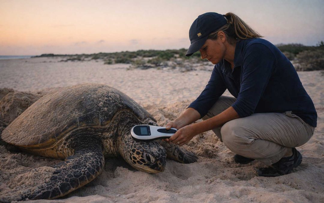
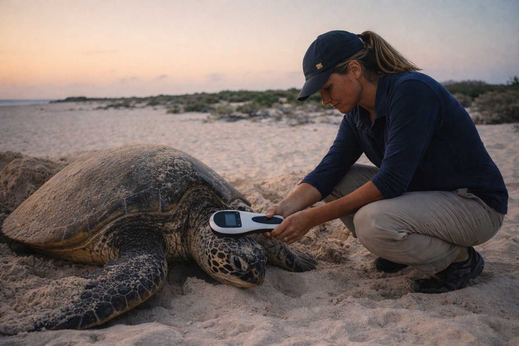
For researchers who want to follow a turtle in real time, satellite transmitters are the tool of choice. A transmitter is attached to the top of the turtle’s shell using an epoxy that is safe for the animal. Each time the turtle surfaces to breathe, the transmitter sends a signal to a satellite overhead, recording the turtle’s location. Researchers on shore can then track the animal’s movement on a map, sometimes from thousands of miles away.
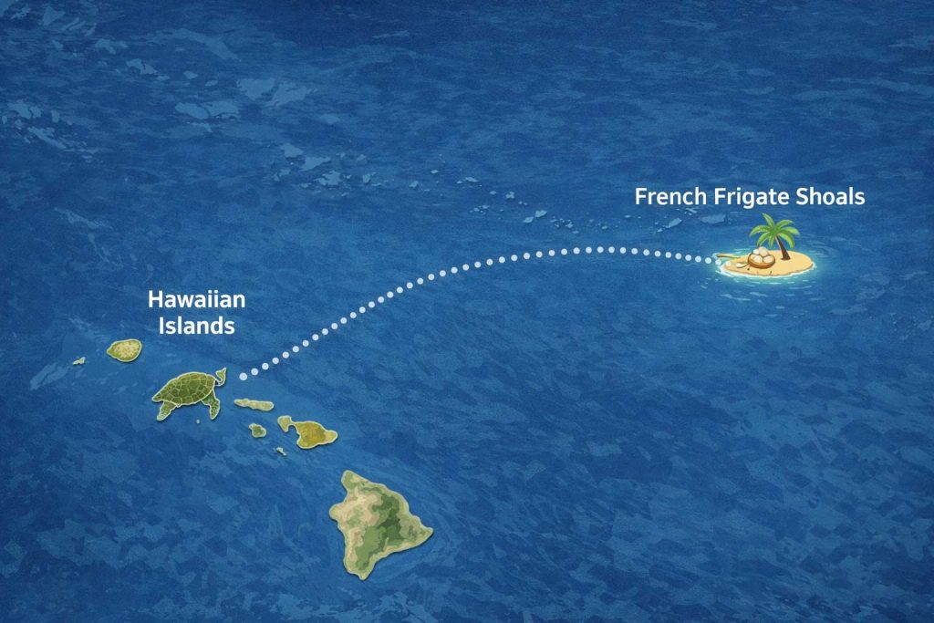
Satellite tracking has produced some of the most dramatic findings in Hawaiian sea turtle research. Turtles that feed on the reefs along Oahu’s south shore have been tracked traveling to nesting beaches more than 800 miles away in the Northwestern Hawaiian Islands, particularly at French Frigate Shoals in the Papahanaumokuakea Marine National Monument. The turtles make this journey without stopping, navigating open ocean with precision that researchers are still working to fully explain. After nesting, females return to the same foraging grounds they left, sometimes arriving within miles of where they started.
Male turtles, which rarely come ashore, have been tracked through satellite tags as well, giving researchers a window into migration patterns that were previously invisible. The data shows that both sexes make these long-distance journeys and that individual turtles return to the same general areas season after season.
French Frigate Shoals: The Heart of Hawaiian Turtle Nesting
More than 90 percent of Hawaii’s green sea turtle nesting takes place at French Frigate Shoals, a remote atoll in the Northwestern Hawaiian Islands about 560 miles northwest of Honolulu. Because it lies within the Papahanaumokuakea Marine National Monument, the atoll is largely off limits to the public, which has helped protect it as a nesting sanctuary. Researchers who visit the site each season count nesting females, measure eggs, and tag turtles, contributing to a data set that now spans more than 50 years.
The long-term data from French Frigate Shoals is what gives scientists confidence that Hawaii’s green sea turtle population has been recovering. Nesting female counts at the site have risen significantly since the 1970s, a trend that aligns with the protections put in place after the ESA listing. That said, the population still faces ongoing threats including ocean warming, habitat loss, and disease, which is why monitoring never stops.
Photo Identification: Recognizing Turtles by Their Faces
One of the most elegant tools in turtle research requires nothing more than a camera and a sharp eye. Every green sea turtle has a unique pattern of scales on its face, particularly around the eyes and on the sides of the head. These patterns are as individual as a human fingerprint, and they do not change over the course of a turtle’s life. Researchers photograph the faces of turtles they encounter and compare the images to an existing database to identify known individuals or add new ones to the catalog.
Photo ID is especially useful in foraging areas like Oahu’s south shore, where turtles return year after year. Volunteers, snorkel operators, and recreational divers contribute to photo databases, expanding the coverage that researchers alone could never achieve. A turtle photographed at Turtle Canyon in the morning might be matched to an image taken at a reef on the west side of the island later in the season, adding another data point to that animal’s story without anyone needing to handle it.
This method has also been used to track the spread of fibropapillomatosis, a tumor-causing disease that affects green sea turtles worldwide. By comparing facial photos over time, researchers can monitor whether an individual turtle is developing new tumors, recovering, or holding steady.
PIT Tags: The Microchip Beneath the Scale
In addition to flipper bands and satellite transmitters, many turtles in Hawaii are implanted with a PIT tag, or Passive Integrated Transponder. Think of it as a microchip similar to what veterinarians use in pets. The small glass capsule is injected into the turtle’s shoulder and stays there for life. It holds no battery and emits no signal on its own. When a scanner is passed over the turtle, the tag activates and transmits a unique identification number.
PIT tags are valuable because they cannot fall off, fade, or be misread the way a metal flipper tag sometimes can. They give researchers a reliable backup identification for any turtle already wearing a flipper tag, and they serve as the primary ID for turtles where the flipper tag has been lost. Over time, as more turtles are scanned and logged, PIT tag databases grow into detailed records that span generations of researchers and decades of fieldwork.
What the Data Is Showing
The combined picture from all of these tracking methods is one of cautious optimism. Hawaii’s green sea turtle population has grown substantially since federal protection went into place, and foraging populations along the main Hawaiian Islands, including on Oahu, have grown alongside the nesting counts at French Frigate Shoals. Turtles that were once rarely seen along Waikiki’s coastline now appear regularly, and experienced guides at Turtle Canyon encounter them on nearly every outing.
At the same time, researchers are watching closely as ocean temperatures continue to rise. Warmer sand temperatures at nesting beaches affect the sex ratio of hatchlings, since sea turtle sex is determined by the temperature of the nest during incubation. Warmer conditions produce more females, and a long-term skew in that direction could eventually affect the breeding population. Satellite data and nesting surveys are central to tracking that shift.
Conservation efforts tied to the tagging programs extend beyond research. When a tagged turtle is found sick or injured, the identification data helps responders understand where the animal came from, how old it might be, and what its history looks like. That information guides treatment decisions and sometimes helps trace the source of an injury back to a specific area or type of hazard.
Seeing a Tagged Turtle at Turtle Canyon
If you go snorkeling at Turtle Canyon off Waikiki, there is a real chance you will spot a turtle wearing a flipper tag. When that happens, note the color and number on the tag if you can get close enough without approaching the turtle. You can report the sighting to NOAA’s sea turtle stranding and reporting hotline or pass the information along to your snorkel guide. That single report might become a data point in a research file that spans decades.
The guides at Turtle Canyon have been watching the same turtles return to these reefs for years. Some animals are recognized by their markings alone, their size, the particular shape of their shells, or a healed scar from an old encounter. That kind of long-term familiarity, built up sighting by sighting over many seasons, is its own form of tracking, and it reflects the same principle behind every photo ID database and tag program in Hawaii: the more you watch and record, the more you understand.
The Quiet Science That Keeps Hawaii’s Turtles Swimming
Sea turtle tagging and tracking is not glamorous work. It involves early mornings on remote beaches, hours of data entry, and years of patience before patterns become clear. But it is that slow, careful accumulation of information that has made it possible to confirm that Hawaii’s green sea turtle population is heading in the right direction. Every tag attached, every photo logged, and every satellite signal received adds to a story that started more than 50 years ago and is still being written. The next time you see a honu gliding through the water at Turtle Canyon, you are looking at one chapter in that story.